QUEENSTON “RIBBON CUTTING” HIKE
Map 1 of 5, Queenston to Grimsby. Niagara Club Section
The southernmost section of the Bruce Trail lies in Queenston, Ontario. Queenston is the more historic areas of Canada.
The weather was -4c, overcast and the wind was quite chilly. I layered up because I wasn’t sure how the conditions would differentiate in the bush and I always want be prepared for changes in the environment. I brought snowshoes, but I didn’t think that I was going to need them. The weather has been unseasonably warm and there was hardly any snowfall.
Find your way to Queenston Heights, and park near the site of the famous British-American battle of 1812. It is also now a great walking park with lots to see, including the amazing view of the Niagara River. Here sits the “Brock Monument” named after General Sir Isaac Brock.
In the park, the ground looked like spring with patches of snow and grass scattered around. There you will also find the Cairn marking the Southern Terminus of the Bruce Trail.
Follow the markings of the trail (2 sets of blazes) as you begin your hike on a paved walkway through the park to the edge of the bush. There you will find the Bruce Trail sign to the entrance of the forest.
The Queenston Quarry
This section of the trail holds many hidden wonders. Old farm houses, parts of the cold war, mine shafts, and even old lime kilns from a local quarry.Soon you will come to the Queenston Quarry established in 1837. The coordinates of these historical sites can be found on the “Ontario Abandoned Places” web-site, as indicated below.
http://www.ontarioabandonedplaces.com/upload/wiki.asp?entry=1773
The Queenston mines:
Prior to the open-face digging of Queenston Quarry, a mine was established here in the 1830s, making it one of the oldest in Canada. GPS is suggested, as there is a maze of paths in this area. Entrance coordinates are: N 43 9.300 W 79 05.369 and can be spotted from a distance by a long line of large limestone blocks that have been placed in front of the entrance area. *remember to go to Ontario Abandoned Places” for coordinates.
Next to see is one of the last remaining rail lines in the area (right picture below). The line was used to transport big chunks of the Dolomite and limestone rock.
Abandoned radio/microwave communications tower
Keep walking and soon you will come upon an abandoned radio/microwave communications tower that sits right beside the trail, and was apparently built in the midst of the Cold-War ’50s. GPS coordinates: N 43 9.360 W 79 4.865
This was a radio/microwave communications tower erected by Fleet Industries in the 1950s during the era of fear of communism. The antenna was part of the DEW (Distant Early Warning) system.Thistower was used to test and calibrate large parabolic dishes.
You’ll see some artifacts here and there left behind by the quarry. Note the stone foundations (mostly off to the left). You can see the 3 marks on the rock. This is where the dynamite was inserted into the rock at the Queenston Quarry.
OFF-TRAIL: A small settlement of houses and a general store were built here as permanent quarters for the workers. The remains of at least three of these buildings can still be found here today. There are other foundation remains further north along the escarpment for those who wish to explore deeper into the bush. This is one of the off path ruins. I didn’t get to it, but maybe one day I will go back to find the Village.
The rest of the hike was pleasant. Some of the hills were a bit slippery, but overall the conditions were mostly snowcovered, but only a few cms worth. I keep having to change my layers of clothing because when the trees opened up the wind brought on that chill. When they were close together I then warmed up again. I didn’t want to over-heat and sweat too much. Once you get wet, your going to get cold. Take the time to inter-change your clothing, as often as the conditions change.
Around the 4km mark you will see the Trail split to the right and left. As indicated by the Trail Blaze (white rectangle means main trail), the main trail continues to the right. (when there are two white blazes, top blaze indicates direction of the main trail.)
The Trail to the left will take you to a fence outlining private property. The a trail to the right is at the 4.2 km point where the Upper Canada Heritage Trail met the Bruce Trail.
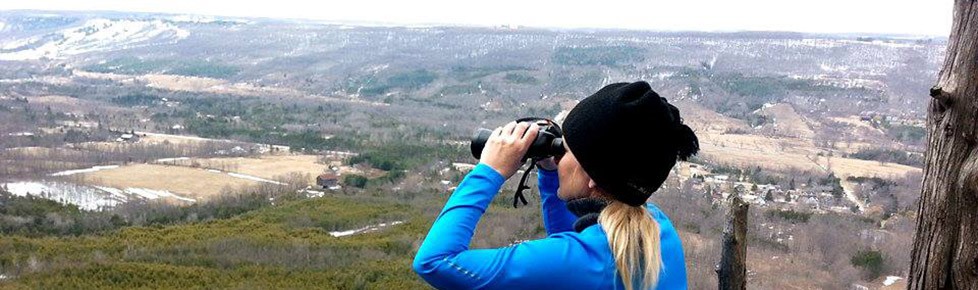
It is here where I doubled back to the main parking lot. Things are always in a different perspective when you view them from the opposite way. One thing that I missed on the way forward was the beautiful Niagara River to my right. I was so busy looking left for the historical sites that I didn’t take an all around look. I saw it on the way back though. I couldn’t believe that I had missed seeing this grand river on the first part of my hike. I was reminded of a lesson in my Search and Rescue days – always take the time to STOP and LOOK UP, BEHIND YOU and a complete 360 TURN ABOUT. Only then can you see all perspectives and minimize missing out on something important!
Niagara RiverLesson: “PERSPECTIVE, what you see depends not only on what you look at, but also on where you look from”!
To follow more of Annette's adventures visit her Blog!! Interested in booking your own Magical Adventure Tour? Hiking, Caving, and survival skills: Magical Adventure Tours